Street View imagery of UWF now available to public on Google Maps
Current and prospective students, alumni and visitors now can get a panoramic view of the University of West Florida main campus from their computer, thanks to the Street View feature in Google Maps.
Current and prospective students, alumni and visitors now can get a panoramic view of the University of West Florida main campus from their computer, thanks to the Street View feature in Google Maps.
UWF was included in the latest release of new street-level imagery in Google Maps that features university and college campuses across the U.S. and many international locations. The Street View feature allows anyone to take a virtual tour of the entire campus from the comfort of their own desktop or mobile device.
To access the imagery, simply search for “University of West Florida” in Google Maps, and either zoom in to the lowest level or drag the orange “Pegman” icon on the left side of the screen onto an area that becomes outlined in blue. From there, it creates the ability to visually explore and navigate around panoramic photos of the campus, moving up and down pathways, and looking around in 360 degrees.
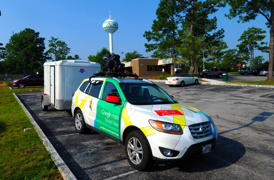
In May, the Google Maps team came to UWF to photograph the roads, paths and walkways in and around campus using a car and a three-wheeled pedicab called the Trike.
UWF is one of more than 150 universities whose imagery was just added to Google Maps on Thursday, Sept. 6.